Montana Word Cloud
Word Cloud > Montana
Montana Information
Before Europeans arrived in Montana, Native Americans settled the land. Then, in the 1800s gold and silver brought many prospectors to Montana. Cattle ranches were started. Montana became a state in 1889. The natural environment of Glacier National Park and Yellowstone National Park attracts many visitors to Montana each year.Authored by jeh. Last updated 2015-08-18 18:17:16.
- Montana Real Estate Guide
Learn about urban, suburban, and rural real estate markets in Montana. Real estate agents, buyers, and sellers will appreciate the Montana real estate resources on this page.
www.local-real-estate.com/montana.htm - Montana Directory
Learn about Montana's demographics and economy, and use the Categories Menu to find businesses and other organizations in Montana.
www.regionaldirectory.us/montana.htm - Montana Map
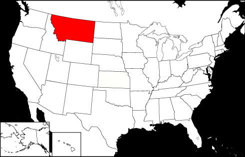
Montana is the 4th largest state in the USA, bordered by North Dakota, South Dakota, Wyoming, Idaho, and the Canadian Provinces of Alberta, Saskatchewan, and British Columbia.
www.state-maps.org/montana-map/ - Montana Atlas
Montana state history, geography, and travel information are the subjects of this Montana atlas page.
www.onlineatlas.us/mt.htm  Montana Road Map (Illustration)
This Montana map page comprises a detailed, scalable road map of Montana, as well as Interstate highway information, scenic road highlights, and state highway department links.
www.state-maps.org/montana-map/road-map.htm- Glacier National Park, Montana (Photograph)
Online gallery photograph of a snow-covered meadow and treeless mountain in Glacier National Park, Montana.
www.onlineatlas.us/gallery/glacier-national-park.htm - Idaho Map
Idaho is the 11th largest state in the USA, surrounded by the Canadian Province of British Columbia and the states of Nevada, Wyoming, Montana, Utah, Washington, and Oregon.
www.state-maps.org/idaho-map/ - North Dakota Map
North Dakota is the 17th largest USA state, bordered by South Dakota, Minnesota, Montana, and the Canadian Provinces of Manitoba and Saskatchewan. Visit this site to find printable maps of North Dakota.
www.state-maps.org/north-dakota-map/ - South Dakota Map
South Dakota is the 16th largest USA state, bordered by North Dakota, Nebraska, Minnesota, Iowa, Montana, and Wyoming. Visit this site to learn more about South Dakota and find printable maps of the state.
www.state-maps.org/south-dakota-map/ - Wyoming Map
Wyoming is the 9th largest USA state, bordered by Montana, Colorado, Idaho, South Dakota, Nebraska, and Utah. Visit this site to learn more and find printable road maps and topo maps of Wyoming.
www.state-maps.org/wyoming-map/ - Pinterest - Montana Board
This gallery page features selected Montana images, including the state flag, a locator map, and various travel photos.
www.pinterest.com/onlineatlas/montana/
Montana Directory Page(s)
- Montana Page on AbiReal.com
Visit this montana category page on abireal.com to find editorially-reviewed resources about this topic.
http://www.abireal.com/info/904/montana-map.html
- Montana Page on Adirectory.us
Visit this montana category page on adirectory.us to find editorially-reviewed resources about this topic.
https://www.adirectory.us/us-states/montana/
- Montana Page on GoGuides.org
Visit this montana category page on goguides.org to find editorially-reviewed resources about this topic.
http://www.goguides.org/topic/1581.html
- Montana Page on Jumblex.org
Visit this montana category page on jumblex.org to find editorially-reviewed resources about this topic.
http://en.jumblex.org/montana/
Montana News
- Promising young cowboy, 16, killed in freak accident after his family moved to Montana and opened ranch
A teen rodeo star who trained horses for professional cowboys has tragically died just months after his family relocated to build their ranch business.
Daily Mail. Mon, 31 Mar 2025 22:02:18 +0100. - GOP governor rallies around historic proposal to slash state's income tax: 'I am optimistic'
Montana is considering making cuts to its individual income tax rate as a growing number of states have completely transitioned to eliminating the tax altogether.
Fox News. Mon, 31 Mar 2025 13:20:31 -0400. - Montana Republican meets with Chinese leader amid tariff tensions
Sen. Steve Daines (R-Mont.), a supporter of President Trump, met Saturday with China's economic chief, Vice Premier He Lifeng in Beijing. This was the first visit by a U.S. ...
Ailia Zehra. The Hill. Sat, 22 Mar 2025 19:35:12 +0000.
Montana Image
 Montana Locator Map
Copyright © 2012-2025 Word-Cloud.org. All rights reserved.